
On the Road —
‘The French Connection’: Interstate Route 11 – A Biography of a Highway in Pictures
Wayne Brew, Montgomery County Community College
Introduction
In the summer of 2013 I started a project that will eventually take me along the whole length of Interstate Route 11 from the border with Canada at Rouses Point, New York (see Figure 1) to just outside New Orleans. The link below will take the reader to a map showing the route of interstate 11 (Last checked August 2014):
http://www.fhwa.dot.gov/infrastructure/us11map.cfm
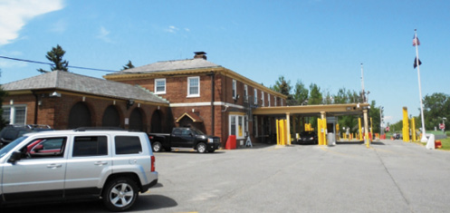
Figure 1. The gateway to Route 11 just north of Rouses Point New York near the border with Canada on the U.S. side. I am sure that there is an image on file of me taking this picture.
Over my lifetime I have traveled large portions of the 1780 miles, but never in a systematic, continuous, and consistent way. My interest in Route 11 started young when it was the main highway that went north/south near my hometown of Wilkes-Barre, Pennsylvania. Most trips by the Brew family started on Route 11 prior to the completion of Interstate 81 in the late 1960s. My project goal is to document the landscape as it exists in the early 21st century, but also peel back the layers of history using the existing structures and United States Geological Survey (USGS) Historical Topographic Maps. The project is not designed to be a full historical assessment, but rather a selective study of the vernacular and commercial structures with a close eye kept open for the reuse of buildings.
In July 2013 I started at the Canadian Border and ended the first part of my journey at Scranton, Pennsylvania. My goal is to complete the rest of the journey over the next two summers, with any luck finishing in New Orleans in the summer of 2015. I travel with my digital camera, an old Boy Scout canteen, topographic atlases, my well-worn copy of Raitz’s Landform Map of the United States. I also pack my trained eyes, informed by Stewart, Lewis, Clay, Sculle and Jakle to name just a few.
Brief History
A good overview of the early history of the interstate highways can be found in the book Divided Highways by Tom Lewis. In the 1920s the clamoring by the public for improved roads along with a great technocratic advocate in Washington DC, James McDonald (Chief of the Bureau of Public Roads), lead to the building of the first numbered interstate system. It did not hurt that the federal government provided 50% of the construction costs. The goal of many of the early interstates was to use existing roads to connect county seats and in the process form continuous and improved (federal standards for paving and bridges) well-marked roads. Despite the generous federal funding the states were not always completely happy with the location of the routes. The link below provides some interesting details about Route 11 (Last checked August 2014): http://www.fhwa.dot.gov/infrastructure/us11.cfm
Peeling back the layers…
What makes traveling the original interstate highways interesting is viewing and documenting the structures built in different time periods. The structures built prior to 1925 existed before the road was designated as an interstate. Figure 2 includes examples of structures prior to Route 11 in New York. After the road was designated as an interstate you can find many examples of vernacular house styles built after 1925 (see Figure 3).
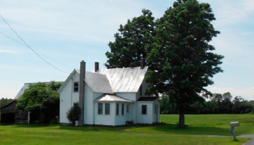
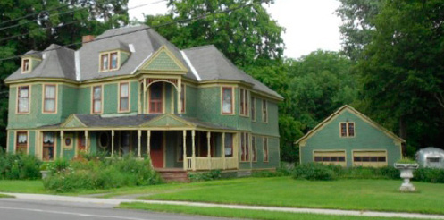
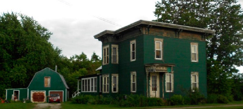
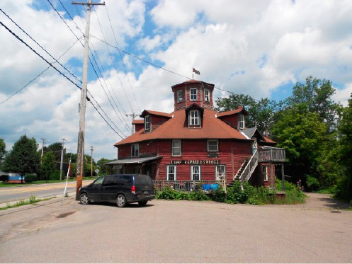
Figure 2. A series of photographs showing structures that existed along the road prior to 1925 interstate status including a nice example of an octagonal structure.
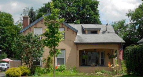
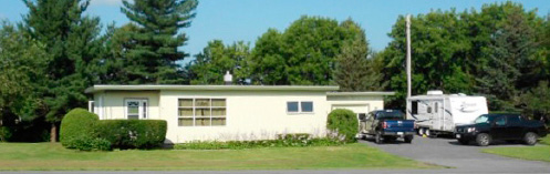
Figure 3. A series of images showing vernacular houses just prior or after the interstate designation including a nice example of a lazy T bungalow (top); a nice mixture of New England Extended folk architecture with 1920s popular style.
Changes…
It is also interesting to note the changes along the route. The USGS topographic maps can be a big help to document old routes that were used for Route 11 in the past in urban areas and by-pass upgrades. This is helpful so that one can follow the present route and the roads used in the past that are now by-passed. The website below is a great help to anyone who wants to figure out routes either before or after exploring them: http://historicalmaps.arcgis.com/usgs/
One of the major changes that can be seen along Route 11 are after the completion of Interstate Route 81 that parallels much of Route 11, especially near interchanges that connect the two roads. A good example of this can be found just north of Sandy Creek, NY where the Route 81-11 Motel is located (see Figure 4). The historic USGS maps clearly show that this motel was built after Route 81 was completed.
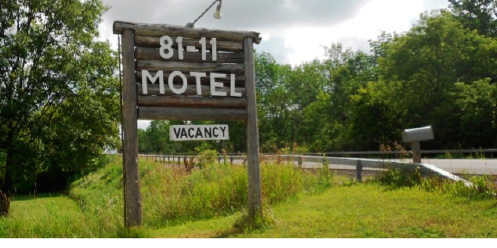
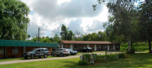
Figure 4. The rustic sign (4a) and the motel (4b) that was built after Interstate 81 was completed.
Diners, Drive-Ins, and Dives
Throughout New York State I was not able to find any visual evidence of stainless steel diners, but did find a closed one just over the border in Pennsylvania (see Figure 5a). A wonderful drive-in (see Figure 5b) can be found just east of Malone, New York. I was not able to find any operating nor visual evidence of closed drive-in theaters in New York State. A survey of the USGS historical topographic maps reveal that several existed including ones outside of the towns of Malone, Canton, Syracuse, and Binghamton.
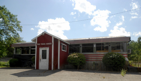
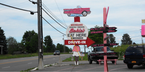
Figure 5. The first steel diner I found on my journey along Route 11 (top). The neon sign for Bokies along with directions and distances to other destinations. French Canadians are welcome here.
(Just as Interstate 81 brought new possibilities it also meant that many commercial establishments are no longer located well. Many of the motels that are still open (dives) have been updated (not necessarily for the better) and are used for apartments and temporary housing. Some of the original signs remain in various state of repair (see Figure 6).
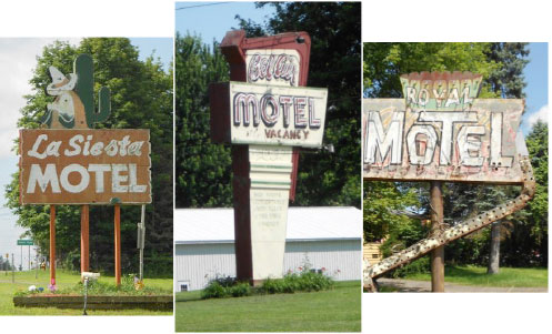
Figure 6. A series of motel signs in various states of repair. In some cases only the sign remains.
Gas Stations
Many gas stations once lined Route 11, but most of the older ones are no longer in use or have been repurposed for other businesses. Figure 7 is a series of images documenting the different styles of gas stations along with some interesting reuses.
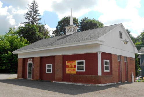
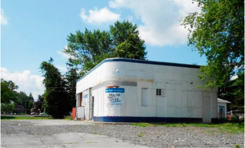
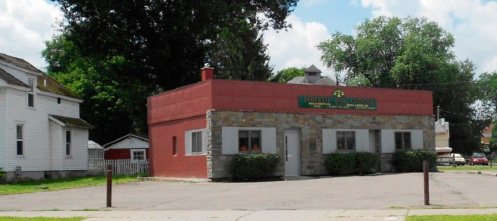
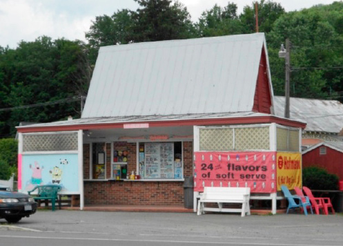
Figure 7. From top to bottom: a colonial style gas station in Pulaski, NY; an Art Deco/Modern gas station outside of Syracuse, NY; an interesting reuse of a gas station as law offices in Cortland, NY; and a former gas station now dispensing ice cream outside of Binghamton, NY.
Monuments and Language
Most of the New York towns have memorials to the Union soldiers for the U.S. Civil War (see Figure 8a). I expect to find the first confederate soldier memorial in Virginia. I found an interesting vernacular memorial to NASCAR (southern) culture early in my journey (Figure 8b). In New York State and most of the rest of the U. S. lunch meat sandwiches on long rolls are called ‘subs’, but just north of Scranton, PA they are referred to as ‘hoagies’ (see Figure 9). The unique name used in Philadelphia (see link below) is not used very far outside of its place of origin. I look forward to when I see my first ‘po’boy’ as I get closer to New Orleans later in my travels on Route 11. Webpage link last checked in August 2014. http://www.phillymag.com/news/2013/06/06/map-proves-philly-city-country-hoagie/
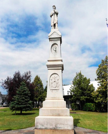
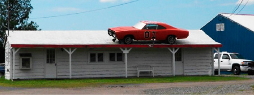
Figure 8. Top: the first of many Union Soldier Memorials found in most of the towns in New York. Below: I found this homage to southern culture far to the north and early in my journey. Both are near or in Malone, NY.
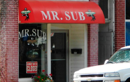
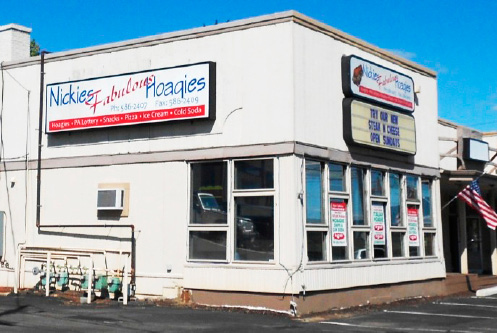
Figure 9. The term sub (submarine sandwich) was found throughout New York State. Mr. Sub (top) is located in Pulaski, NY. The first ‘hoagie’ shop was found near Clarks Summit, PA, north of Scranton.
New Layers, New (Continued) Journeys
I titled this essay the French Connection because Route 11 links Quebec with New Orleans. It was interesting to see the recent landscape additions of more recent Latino and Southeast Asian migrants along Route 11 which are shown in a series of photographs seen in Figure 10.
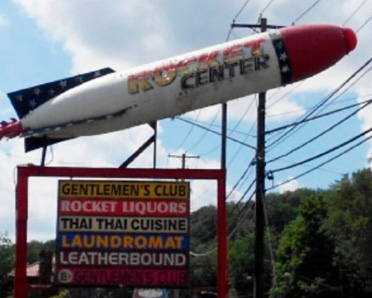
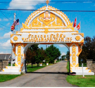
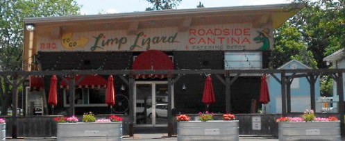
Figure 10. Recent migrants have added their own distinctive layer to Route 11. Hispanic influence can be found on display north of Syracuse NY. Asian influences run from the commercial to the sacred. The ‘Rocket Center’ is south of Binghamton and the Buddhist Temple is located near Castle Creek NY. The lizard may be limp, but the rocket tells a different story.
This concludes the first stage of my travels along Route 11. I look forward to reporting Stage 2 of the journey from Scranton, PA to Knoxville, TN in PAST 2015.
Return to top